
Not everything was as I planned. I was searching for a line shape file of the London's cycle lanes, as logical would be adding length of cycle lanes per ward or any data set saying about an average commuting distance to work. I asked Transport for London and a few cycling organizations based in London for the shape file but nobody was able to help me.
There's a bit mysterious term on my map that should be explained so below you have the definition.
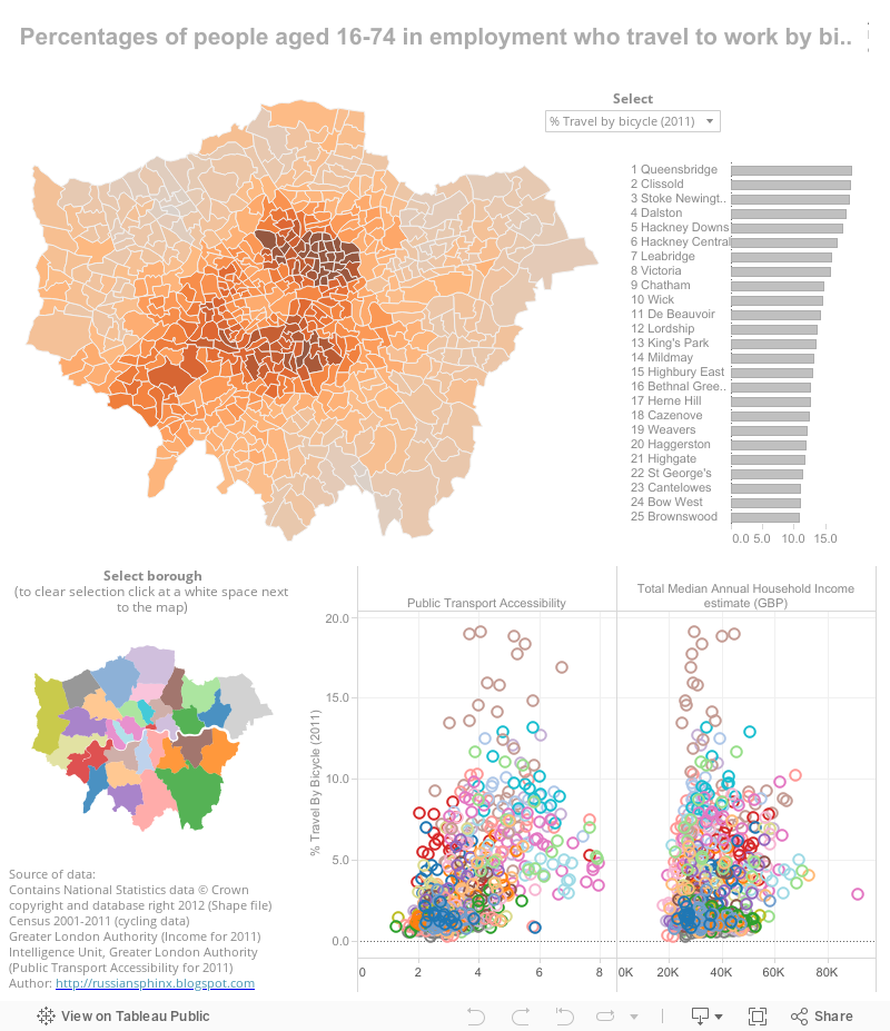
The Public Transport Accessibility is measure of the accessibility of a point to the public transport network, taking into account walk access time and service availability. Each area was given an average score out of 8, where 8 is the highest level of accessibility.
Learning more about the situation of cyclists in London I found a few things worth sharing:
Analysis of Cycling Potential, PolicyAnalysis Research Report
Cyclodeo - internet users add their trips recorded
on a cam to map of London and a few other cities.
Traffic in London from a Dutch
perspective:
Would you dare?
:) photos of one particular person
commuting to work :)
<blush> I was so desperate to get
the shape file that I was begging Boris on Twitter <blush> who
said that working with data is boring.
The interesting fact about London is
that there're so many open data sets for the city (the one I needed
wasn't but still I appreciate). Comparing to other cities it's a
unique situation. If you have a hunter's nature, you'll be bored that
everything is so easily accessible lol
No comments:
Post a Comment